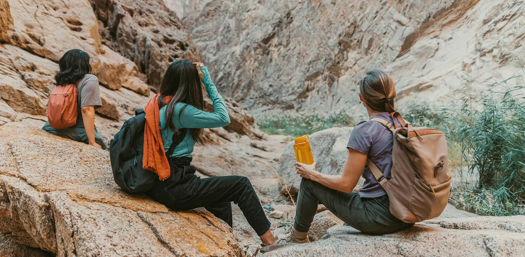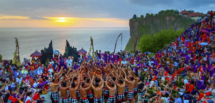


Kauai's North Shore coastline and tropical, mountainous interior invite outdoor enthusiasts to discover the mystical canyons, cascading waterfalls, secluded beaches, and rugged cliffs of this emerald gem of a paradise.

With gorgeous Lake Wakatipu at its doorstep and dozens of other lakes and rivers a stone's throw away, Queenstown is simply made for water-related activities.

While 70 percent of Hong Kong is considered green space, over half of Lantau Island's 56-square miles are dedicated parks.

Kota Kinabalu is the gateway to one of the world's most fascinating islands where warm seas and white-sand beaches diminish into lush, tropical forests and Southeast Asia's 10th highest mountain looming over the city.

From an adrenaline-infused day spent downhill mountain biking in the Andes to a five-mile hike on an easy-going trail across Isla del Sol in Lake Titicaca, discover both natural and cultural beauty in La Paz's altiplano playground.

Flanked by three volcanoes, Antigua's smoking mountainous backyard beckons to summit-seekers and pyromaniacs eager to try lava-roasted marshmallows.

Soft white beaches and rugged limestone cliffs fringe Croatia’s 3,900 miles of coastline, which wraps along the west coast and around the country’s 1,244 islands, islets, rocks, and reefs.

In the eastern Scottish Highlands, about three hours north of Edinburgh by road.

Located off Scenic Highway 12 in Southern Utah, Bryce Canyon National Park is 56 square miles of sunset-colored rock, pine tree forests and varied trails.
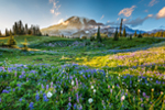
National Park: Mount Rainier National Park, Ashford, Washington
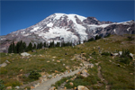
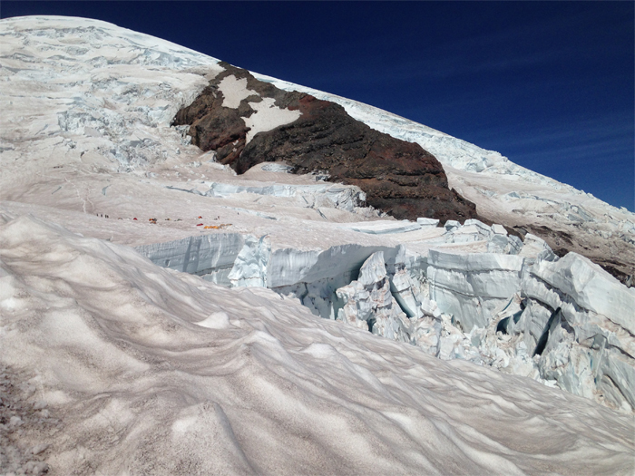
Glaciers – with 27 glaciers covering 35 square miles, Mount Rainier has more of these massive ice and snow fields than any other peak in the lower 48 states. Emmons Glacier is the largest on Rainier, covering an area from the White River Valley all the way to the summit, making it a popular mountaineering route to the peak, though the glacier becomes heavily crevassed in late summer.
Melanie Ott
Established in 1899, the park covers 370 square miles and surrounds the park’s name sake: Mount Rainier, the tallest peak in Washington state at 14,411 feet elevation. Mountaineering is a huge draw, with thousands attempting the summit each year and a success rate hovering around 50 percent.
The Summit
Summiting Mount Rainier is not for the faint of heart or the unexperienced, as technical skill, strength and endurance are required. Adding to the mix altitude and the occasional ladder crossing, this is not for the casual hiker, and we do not recommend you attempt the hike unless you have mountaineering experience and training. But if you do, and have the determination to tackle the beast, it’s a feat you’ll never forget.
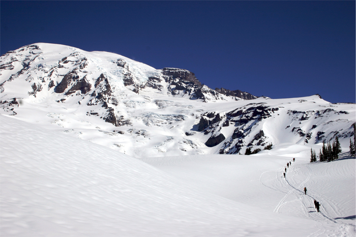
Several routes lead to the summit, but the most popular and easiest (depending on mountain conditions) is Disappointment Cleaver via Camp Muir, which provides sheltered bunks and pit toilets for a more comfortable night on the mountain. Some decide to push to the summit from Camp Muir, while others trek a short distance to Ingraham Flats, set up camp and prepare for an "alpine start" around midnight to beat afternoon storms and avoid sun-melted slushy trails.
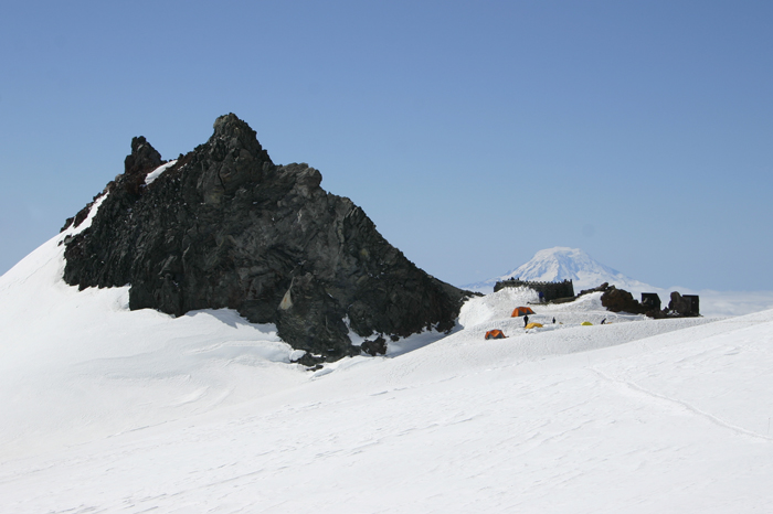
Sunrise on the mountain is breathtaking when you finally have a clearer view of your surroundings, which at times are almost otherworldly. The final ascent reaches the north rim of the crater, with the summit post waiting a couple of hundred yards away on the other side. The top of Mount Rainier is so broad, you aren’t looking down, but rather out to the horizon in all directions from the highest point in Washington State and the Cascade Range.
In addition to experience and training, you’ll need to obtain a climbing pass (good for the calendar year) and wilderness permit (single-trip use) to stay overnight. Stop by the ranger station with a photo ID to register and pick up permits and passes. Winter storms are a hazard, but storms that prevent summiting can occur any time of year. Later in the season, the number of exposed crevasses increases as glaciers melt. We recommend calling the station or going online to check current mountain and route conditions ahead of time.
Those not looking to peak bag can hike around the lower areas of the park. The Wonderland trail leads around Mount Rainier in the backcountry, covering 93 miles of rugged mountain terrain climbing and dropping elevation along the way. There are several campsite options in the backcountry, but a wilderness permit is required. See below for information on backcountry camping and permits.
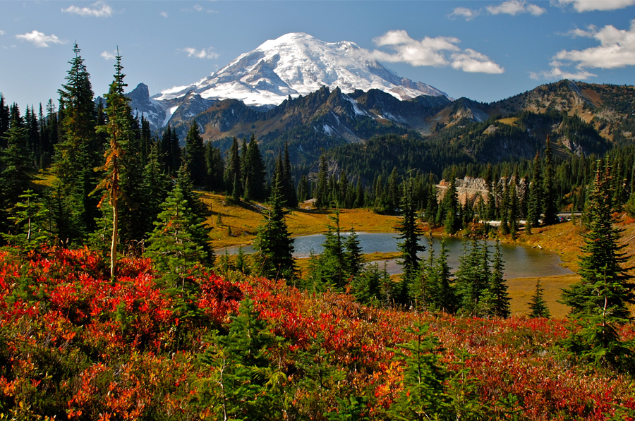
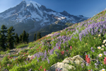
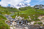
For simpler day hikes, the park maintains over 260 miles of trail around the mountain that wander through forests and meadows where you’ll find gardens of subalpine wildflowers during the peak blooming months of July and August. You can hike up to Camp Muir without a permit, and you’ll find sledders, skiers and boarders along the way taking advantage of the year-round snow-covered field leading up to camp.
Most camping in the park as well as permits for wilderness and backcountry campsites are issued on a first come, first served basis, and can be acquired the day before you begin your adventure. This is a change in process for the 2016 season as the park is testing a new reservation system; the process for the 2017 season and going forward is TBD, but the park website will have updates throughout the winter. Also, you can make reservations for Cougar Rock and Ohanapecosh campgrounds online at recreation.gov.
For indoor lodging, you have two choices inside the park. National Park Inn is open all year and has 25 rooms, a general store, and a rustic casual restaurant and lounge surrounding a grand stone fireplace. Paradise Inn—celebrating its centennial in 2016—is open from May to October, with 121 guest rooms, café and large dining room. Reservations for both park inns are made with guest services, and can be booked online.

Cycling inside the park is limited to paved roads, which can provide challenging and steep climbs, such as 3,400 feet gain over the 19-mile ride from Nisqually to Paradise, or 3,650 feet gain over 20 miles pedaling from the northeast entrance to Sunrise. But for off-road mountain biking, head to nearby trails like Deep Creek Trail, gaining over 3,000 feet in 4 miles, or Crystal Mountain 14-mile loop with 3,500 feet elevation gain. For more trail options, have a look at visitrainier.com.
Fishing success inside the park can be inconsistent; however, you’ll find better luck in areas outside of the park: visitrainier.com lists a number of good fishing rivers and creeks, including the best seasons to catch specific breeds. Although you can fish license-free in several locations in the park, Washington State fishing regulations apply to dates and water-source use, and a fishing permit is required outside of the park.
Mount Rainier National Park is open year round, and is most heavily visited during the peak-season months from late spring to fall, but the park attracts winter wanderers seeking sledding, snowshoeing, cross country skiing and other snowy activities. Some visitor centers close or have limited operating hours during the winter, and several campsites and picnic areas close entirely during winter months. If you plan to mountaineer, climb or camp during the off season, make sure you check the website for operating hours as well as to verify any road closures and trail conditions.